Trail Walking La Chapelle-sur-Coise - Duerne La Chapelle sur Coise B 17.1km 521m 5h - Photo

Duerne La Chapelle sur Coise B 17.1km 521m 5h

© OpenStreetMap contributors
Length
Length
17.1 km
Max alt
Max alt
928 m
Uphill gradient
Uphill gradient
532 m
Km-Effort
Km-Effort  
24 km
Min alt
Min alt
673 m
Downhill gradient
Downhill gradient
530 m
Boucle
Boucle
Yes
Creation date :
2019-03-09 18:48:15.012
Updated on :
2019-03-09 18:48:15.057

(0 Reviews)

Walking
Walking
5h04
Difficulty : Medium

Scan this QR Code to open this trail in the SityTrail application

FREE GPS app for hiking

Logo SityTrail SityTrail

IGN / Geographical institutes

Download SityTrail from the App Store Download SityTrail from Google Play

Logo SityTrail SityTrail World

The world is yours!

Download SityTrail from the App Store Download SityTrail from Google Play Download SityTrail on Huawei AppGallery

About

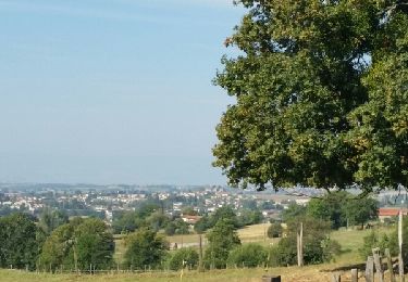
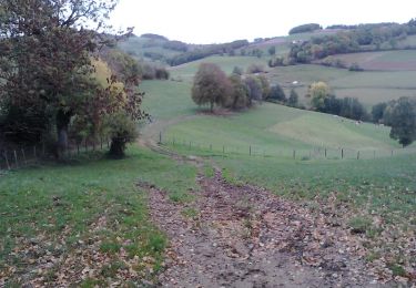
Trail Walking of 17.1 km to be discovered at Auvergne-Rhône-Alpes, Rhône, La Chapelle-sur-Coise. This trail is proposed by Bobosse69.

Description

Boucle sens anti-horaire départ et arrivée parking Salle des fêtes. Au point 844 prendre à gauche,profiter du panorama de la table d''orientation, et au retour tourner vers le Layat, curiosité à la Roche Sanson, puis Ardaison, le Birieux, le Molard, Pitaval, la Chavanne.

Elevation profile

Positioning

Country:
France
Region :
Auvergne-Rhône-Alpes
Department/Province :
Rhône
Municipality :
La Chapelle-sur-Coise
Location:
Unknown
Start:(UTM)
616877 ; 5056825 (31T) N.

Comments

Please log in to post a review or rate the element


Trails nearby

Trail Mountain bike Saint-Martin-en-Haut - 19ème Croisée des Monts du Lyonnais (2012-VTT-25km) / Saint-Martin-en-Haut - Photo
Mountain bike
tracegps

Mountain bike

Medium
(1)
Saint-Martin-en-Haut, Auvergne-Rhône-Alpes, Rhône, France
25 km | 35 km-effort
2h 45min
Yes
Trail Walking Duerne - Randonnée des collines autour de Duerne  - Photo
Walking
dudu42

Walking

Medium
Duerne, Auvergne-Rhône-Alpes, Rhône, France
15.5 km | 22 km-effort
4h 2min
Yes
Trail Nordic walking Saint-Martin-en-Haut - Quéser à St Symphonie sur Croise - Photo
Nordic walking
pierre_mack

Nordic walking

Easy
Saint-Martin-en-Haut, Auvergne-Rhône-Alpes, Rhône, France
8.7 km | 11.3 km-effort
2h 38min
No
Trail Nordic walking Saint-Martin-en-Haut - St Martin en Haut à Duerne - Photo
Nordic walking
pierre_mack

Nordic walking

Easy
Saint-Martin-en-Haut, Auvergne-Rhône-Alpes, Rhône, France
14.8 km | 19.8 km-effort
5h 33min
Yes
Trail Walking Pomeys - la Neyliere - le Voiturin - Photo
Walking
godbillon

Walking

Easy
(1)
Pomeys, Auvergne-Rhône-Alpes, Rhône, France
10.1 km | 13.6 km-effort
1h 54min
Yes
Trail Mountain bike Saint-Martin-en-Haut - Balade VTT à St Martin En Haut - Photo
Mountain bike
tracegps

Mountain bike

Difficult
Saint-Martin-en-Haut, Auvergne-Rhône-Alpes, Rhône, France
25 km | 35 km-effort
2h 30min
Yes
Trail Walking Saint-Martin-en-Haut - St Martin En Haut 2013 - Photo
Walking
tracegps

Walking

Medium
Saint-Martin-en-Haut, Auvergne-Rhône-Alpes, Rhône, France
22 km | 29 km-effort
5h 0min
Yes
Trail Mountain bike Saint-Symphorien-sur-Coise - La 4ème Pelaude (2013-VTT-45km) - Saint-Symphorien sur Coise - Photo
Mountain bike
tracegps

Mountain bike

Very difficult
Saint-Symphorien-sur-Coise, Auvergne-Rhône-Alpes, Rhône, France
45 km | 62 km-effort
5h 0min
Yes
Trail Mountain bike Saint-Martin-en-Haut - 19ème Croisée des Monts du Lyonnais (2012-VTT-60km) - Saint Martin en Haut - Photo
Mountain bike
tracegps

Mountain bike

Very difficult
Saint-Martin-en-Haut, Auvergne-Rhône-Alpes, Rhône, France
61 km | 88 km-effort
6h 0min
Yes


Close
My subscriptions